La Jonchère St Maurice, France
Pilot Description
The use case in France is called “Forest fire with Industrial accident in highly explosive plant” and will take place during 2023 is related to Phases A & B. The place where the pilot will take place is called La Jonchère St Maurice which is a rural area in Haute-Vienne, Nouvelle Acquitaine – 34 km in the northern part of Limoges.
Many industries with high risk of human dimensions (for example SEVESO industries) are situated near residential or rural areas. Managing a major accident in a delicate situation of forest fire is a challenge, and with the production of smoke cloud and explosive, it is always important to minimize further risks.
Scenario description:
The forest fire scenario has three active fronts, moving towards sensitive targets; With a large amount of smoke and a wind exceeding 70km / hour, the firefighters urgently need priority information:
– Mapping of the area,
– Identification of access paths,
– Urbanized areas,
– Roads and access routes,
– Temperature, dehydration of plants,
– Speed and direction of the wind,
– Anticipation of fire development and development axes,
– Integration of changing weather conditions.
Fire spread:
The fire is being developed depending on the wind’s direction with a speed progressing with at least 3% of the speed’s wind. Then, under the influence of the swirling wind, the fire takes different directions producing vortices, while the height of the flames is increasing.
Aerial views:
As the firefighters are using these tools, they will be able to see the smoke and other potentially toxic plumes. They will also be able to view and anticipate the use of the access tracks. This allows first responders to anticipate access and positioning of response vehicles.
The use of several drones simultaneously will:
– Measure the ground temperature of the flames and fumes, the speed and direction of the wind with different sensors, over the entire intervention area in order to anticipate the propagation, this information provided continuously will allow the area to be assessed towards which the fire will spread (residences, industries, roads etc …).
– Integrate the measurements made by sensors positioned in vulnerable forest areas.
– Drones equipped with gas sensors will make it possible to know the composition of the combustion gases and their dangers for the operators.
Technological risks:
The combination of a forest fire risk and a technological risk is an important issue. The consequences of a site explosion or the threat of a chemical dispersion are dramatic.
Scenario:
Fire start:
An outbreak of fire near a traffic lane is a highly probable assumption in the scenario given the statistics we have in our disposal. The unfavorable meteorological conditions (drought, wind, dehydration of plants, etc.) and the type of plants promote rapid development of the fire.
Fire starts from «Au moulin de Panéche» with a wind in the zone of 146 ° direction of « Puy de la Jasse », for about 2.3 kms. In the main axis of propagation is the TITANOBEL site which is threatened about 1.8 km from the start of the fire.
Depending on the weather conditions (especially the wind) the site is directly threatened for example:
– Wind from 50 km to t + 80mn,
– Wind from 30 km to t+ 120mn.
Kinetics and chain of events:
The previous stages of the scenario will permit, by identifying the possible outbreaks of fires, the elements and human actions that may have an impact on the fire, to identify the possible components of the fire scenarios which will lead to a threat for an installation classified as risks.
- Fire start: proximity to a traffic lane, mapping,
- Nature of vegetation: mixture of deciduous and coniferous trees varying the speed of propagation, use of different sensors,
- Propagation: high speed given a strong wind, of the order of 70 to 80 km / hour,
- Direction: the focus is developing towards a production unit for explosive products,
- Anticipation :
– Calculation by the command post of propagation cones, mapping,
– Identification of threatened targets, nature and quantities,
– Possible chronological sequence, anticipation scenario.
1st event: impact on a technological risk installation
– Time to reach the installation at risk, chronology of events,
– Implementation of protection or evacuation measures,
– Measures to be taken in case of failure of the measures implemented: explosion and spread of fumes.
2nd event: impact on an habitation area
– Time to reach the urbanized area, chronology of events,
– Implementation of protection or evacuation measures,
– Measures to be taken in case of failure of the measures taken.
Pilot Implementation
The French pilot consisted of the educational and promotional exhibition at the Limoges City Hall and of the pilot exercise in St Sylvestre. The pilot implementation took place between September 29th and October 1st, 2023.
The exhibition in Limoges City Hall featured a poster exhibition and a first look at the citizen engagement app, which the visitors had the opportunity to test.
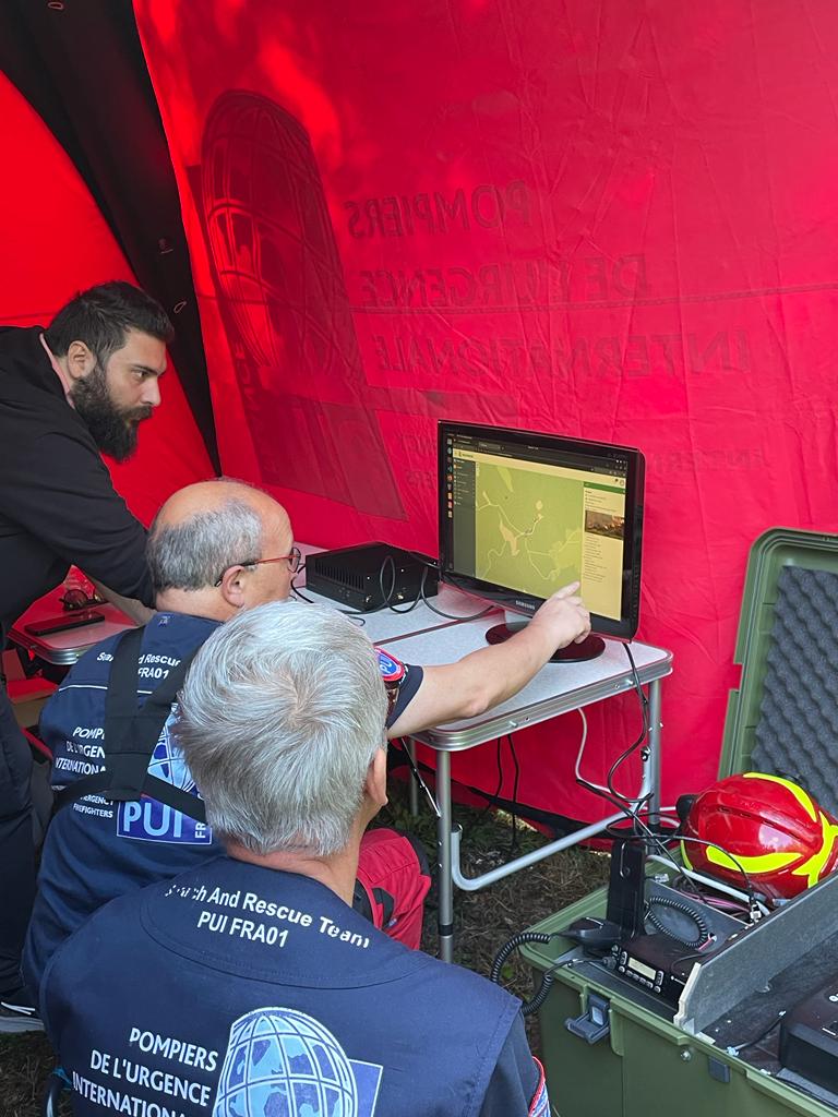
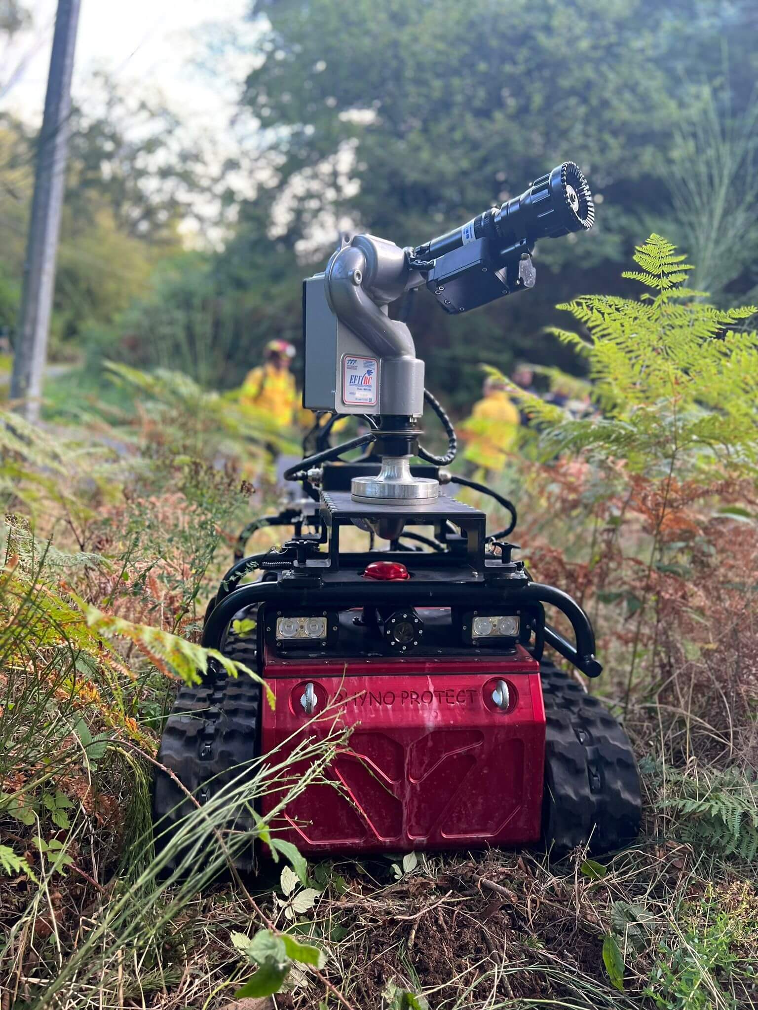
Led and managed by SILVANUS partner International Emergency Firefighters (PUI), the exercise in St Sylvestre featured a roadside fire outbreak scenario. Woode biodiversity app, citizen engagement app, fire detection sensors, fire detection using social sensing system, robots and drones were tested.
The exercise was conducted in front of more than 70 attendees from 10 countries, including National Forest Office in France, Municipality of St Sylvestre, and SILVANUS Consortium members.

