Moravian-Silesian Beskydy Mountains, Czechia
Pilot Description
Moravian-Silesian Beskydy Mountains, Municipality of Krásná, Czech Republic
The pilot area is situated in the north-east part of the Czech Republic and the eastern part of Moravian-Silesian Region, at the territory of Moravian-Silesian Beskyds Mountains. Beskydy Mountains are the northern territory of Protected Landscape Area Beskydy (PLAB). East border of the PLAB is located at the national border with Slovak Republic. The territory of PNRB belongs to most visited tourist resorts in the Czech Republic. The overall area of the Protected Landscape Area Beskydy is 1160 km2. with the highest mountain, Lysá Hora, with an altitude of 1323 meters. Lowest areas of PNRB have got the altitude approximately 400 metres. The pilot site is located within the Krásná municipality.
Approximately two thirds of the PLAB are covered by forests, and a significant part presents old growth deciduous and coniferous forests. The reason for declaring the Beskydy Protected Landscape Area was its exceptional natural values, especially the remnants of the original primeval forests with the occurrence of rare Carpathian animals and plants. The Beskydy Mountains are famous for their highland meadows and occurrence of rare Carpathians plants and animals. Also noteworthy are the species-diverse meadows and pastures, unique surface and underground pseudo-karst phenomena. The Beskydy landscape still has an extraordinary aesthetic value, which was created by the historical coexistence of man with the mountains.
The climate of the Beskydy Mountains is influenced by their location in the central part of Europe. The influences of the oceanic and continental climate meet here. The oceanic air masses bring weather with mild winters, colder summers, heavy clouds and heavy rainfall. Continental air is characterized by daily and annual temperature fluctuations, less precipitation and clouds. The fragmentation of the relief also has a great influence on the climate. As the altitude rises, the temperature and atmospheric pressure decrease and other climatic factors are also influenced. According to the climatic division of the Czech Republic, the Beskydy region belongs to the category of cold areas.
Scenario
Territory of PLAB is frequently affected by wildfires and other nature related emergencies (strong winds, floods, flash floods, landslides). Historical report on wildfires contains overall 146 nature fires in Moravian-Silesian Beskydy Mountain from 2010. These fires caused the direct losses approximately 200,000 € and 326 hectares of affected territory.
Long time period of high temperatures and draught causes high risk of wildfires. A wildfire occurs often at the mountain territory of the Krásná municipality.
1st Pilot Implementation in 2023
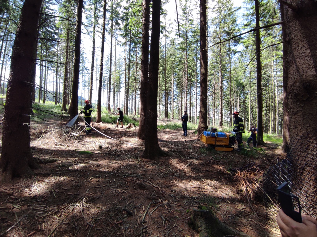
The main organiser of the pilot exercise in 2023 was the SILVANUS team member Fire Rescue Service of Moravian-Silesian Region. User products of the SILVANUS platform that were tested at the site were: the Unmanned Ground Vehicles (ground robots) by 3MON that simulated extinguishing fires, transporting wounded and cargo over uneven forest terrain, the Woode biodiversity app by Venaka TReLeaf, along with Unmanned Aerial Vehicles (drones for survey and data-sharing), Citizen Engagement Mobile App, SILVANUS Dashboard, wildfire detection system, forest firefighting appliances and equipment, with support by SILVANUS partners Center for Security Studies (KEMEA) and Institute of Informatics, Slovak Academy of Sciences.

2nd Pilot Implementation in 2024
For the pilot exercise in 2024, the SILVANUS platform was tested in its fully integrated form. While the 2023 exercise focused on testing the individual user products and collecting data, the 2024 Czech exercise was the first one in the 2nd trial period (starting in June and lasting until October 2024) to test the SILVANUS platform and its integrated components.
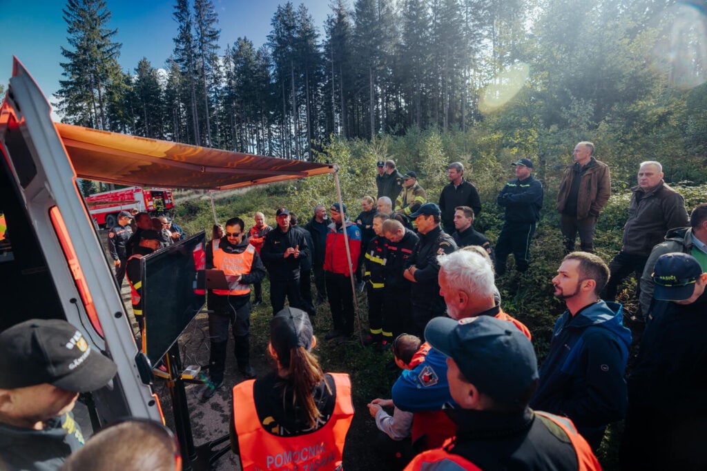
The three-day pilot demonstration, organised again by the Fire Rescue Brigade of Moravian-Silesian Region, consisted of a workshop, an exhibition of SILVANUS key messages, and the demonstration exercise. The 1st day focused on the rehearsal for the pilot demonstration. The workshop took place on the 2nd day, along with the poster and prop exhibition for project partners and shareholders. The venue of the workshop and exhibition was the Technical University of Ostrava, Faculty of Safety Engineering, where the project was introduced and the platform was described in detail. Stakeholders from various fields of expertise, such as local authorities, academia, civil protection, firefighters and business sector, were consulted on the benefits of the platform.
During the pilot exercise in the Kyčera territory, Municipality of Krásná, platform components that were thoroughly tested were the fire detection on social sensing, fire detection from IoT devices, fire detection using UAVs (drones), fire detection using ground robots (UGVs), fire spread forecast, citizen engagement app, Woode biodiversity app, health impact assessment, evacuation route planning, fire detection at the edge, MESH-in-the-Sky, and the SILVANUS dashboard.
There were 60 participants in total at the pilot demonstration exercise, consisting of first responders (firefighters, police, mountain rescue), researchers, stakeholders (foresters, river management organization), authorities (municipality), ICT industry, NGO, and media.
The pilot exercise has been reported in the media and through video coverage. This was a successful endeavour that introduced the SILVANUS platform to a wide variety of stakeholders and will serve as the launching benchmark for the rest of the SILVANUS pilots in 2024.
