Evacuation Route Planning
Evacuation Route Planning (DSS – ERP)
The Evacuation Route Planning component is a part of the SILVANUS project framework that aims to enhance the safe relocation of firefighters, first responders and citizens from regions that have been confirmed as facing immediate or imminent threat from a wildfire. This danger stems from the vulnerability of the human organism to very high temperatures and exposure to toxic substances produced by biomass burning.
Making use of the outcomes of other SILVANUS components, such as fire spread forecast (UP6) and inputs from diverse sources (e.g., meteorological and vegetation data) and implementing appropriate models, this component is able to estimate the shortest safe evacuation route.
The primary characteristics of this component encompass integrating smoke dispersion, as well as fire propagation forecasting into the evacuation planning process, identifying the most effective routes for evacuation that do not intersect within fire and smoke affected areas and establishing the duration during which this route is considered safe.
The produced information is available to stakeholders through the DSS and appropriate RESTful APIs.
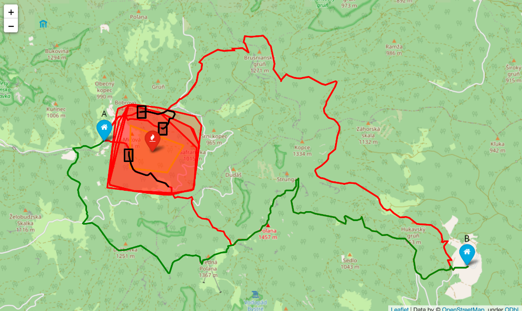
In the following figure the results of the component are visualized by exploiting EXUS fire spread prediction (red polygons) as derived from the fire front (yellow polygon) granted by ITTI in the area of the Slovak pilot. The algorithm succeeds in determining a safe evacuation route to transport the individuals from point A to point B (green line).
